
Technology Groups
Four Technology groups support Riverside County Fire Department's life-saving systems:
- Communications (COMM) - Communications enables Operations and Dispatch Personnel to send and receive messages and data throughout the County.
-
Geographical
Information Systems (GIS)
- The GIS Group provides graphical mapping services to
enhance firefighting and management operations.
- Information Technology (IT) - Information Technology installs and maintains hardware/network technologies to support users, systems, and communications.
- Applications (APPS) - The Applications Group builds and maintains system and software tools for managing Fire Department functions.
Communications
The Communiations section provides high quality, effcient and cost effective communications support for CAL FIRE/Riverside County Fire Department, and the residents of Riverside County. We take pride in dedicating ourselves to professionalism and public service.
The Communications section is responsible for:
- Landline based Telephone Systems
- Satelite Telephone Systems
- Cellular Communications Systems
- Microwave Communications
- Dispatch Support Systems
- Specialized systems operating on Emergency Response Vehicles
- Paging Systems
- Coordination with Telecommunications Providers
- Coordination with State and County Service Providers

Geographic Information Systems
Scope and Services
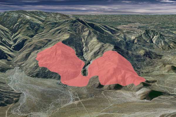
Riverside County Fire Department GIS is a community leader in providing full service, professional, geographic information services to support and enhance the effectiveness of department decision making.
Maps, data, and analysis produced by Fire GIS allow department decision makers to consider and visualize important factors about emergency and non-emergency situations via products that are simple to understand and easy to communicate with others.
The Roads Model
The Riverside County Fire Department in cooperation with the California Department of Forestry and Fire Protection works closely with State, County, Cities, and Local Agencies to ensure the accurate and timely maintenance of the road system model.
One way current information about roads is collected through the use of an internet map server IMS. Stations and field personnel can "mark up" an online map from their station computer and submit any address or road changes to Fire GIS at headquarters. The roads model is then changed by the GIS staff in response to these requests via the IMS system. This results in better service to the department and the community that we serve.
Fire GIS Support Staff Activities
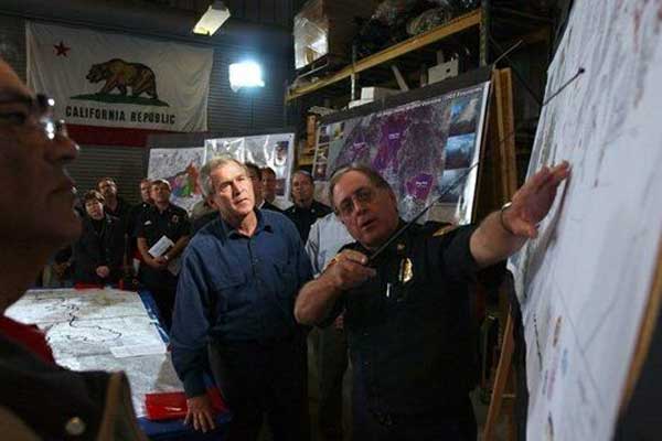
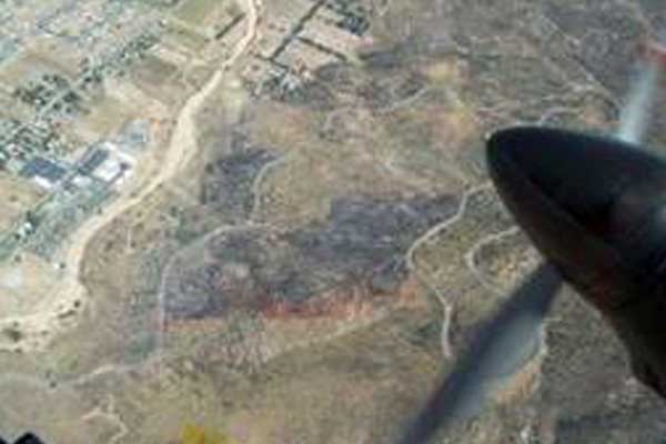
GIS Staff can be assigned to any emergency incident that requires the tracking, communication, or display of geographically significant information. Natural disasters such as fire, flood, earthquake or other disasters such as weapons of mass destruction or nuclear/biological terrorism require the collection, analysis, and display of the geophysical and human factors involved. Information processed by Fire GIS helps to discover data trends/relationships and bring information together in a way that helps emergency managers make better informed decisions based on the best available data.
Information Technology
The Information Technology section (IT) of the Communications/IT Department division, develops and maintains networks and systems infrastructures for CAL FIRE/Riverside County Fire Department. IT supports over 100 remote facilities, including:
- Fire Stations, Camps, Air Base Operations
- Emergency Operations Centers and Emergency Command Centers
- Mobile Communications Units
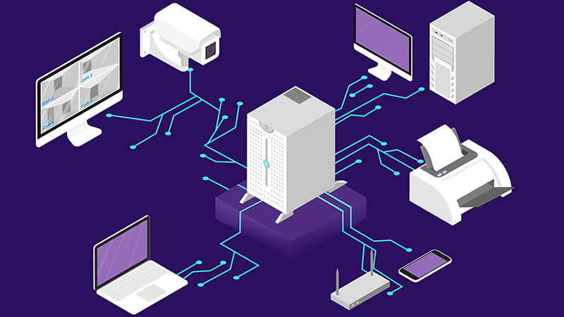
The equipment and operating systems managed by IT support mission critical applications:
- Computer Aided Dispatch (CAD) and Dispatch Printing Systems
- Geographic Information Systems
- Specialized applications that facilitate safety operations
- Rugged computing equipment designed to operate in the field
Applications
The Applications Section of the Communication/Technology Division works closely with Riverside County Fire Department's Communications, Information Technology and Geographical Information Systems groups. This ensures that all our projects benefit from integrated technologies.

Applications section is responsible for:
- Review, Recommendation and Implementation of any off-the-shelf Software products
- Design, Development, Training and Support of Software and Interfaces
- Statistical Extraction and Reporting of vital information